ENSO Alert System Status: El Niño Watch
Synopsis: El Niño is likely to emerge soon (82% chance in May-July 2026) and continue through Northern Hemisphere winter 2026-27 (96% chance in December 2026-February 2027).


ENSO Alert System Status: El Niño Watch
Synopsis: El Niño is likely to emerge soon (82% chance in May-July 2026) and continue through Northern Hemisphere winter 2026-27 (96% chance in December 2026-February 2027).
Drought intensified in the Northwest, the Plains, Mid-Atlantic, and the Northeast, and eased in Colorado, the South, Southeast and Maine. Drought covered 61.47% of the contiguous US, up 0.55 points from last week.
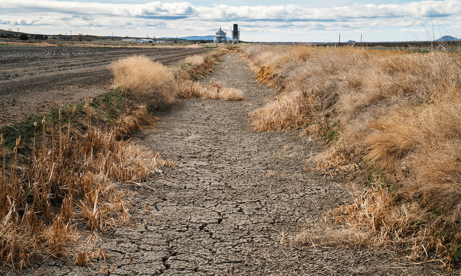
Dry conditions are so intense that they are keeping farmers from planting in some parts of the country.
Wyoming Ranchers Selling Off Cattle As Drought Tightens Grip Across State
Wyoming’s largest livestock marketing company sold 9,000 head of cattle in a special drought sale on May 13 when it typically sells 400-700 head a week. Grass is scarce, and feed supplies are tightening.
Something weird and worrying is happening with rain, study finds
New research shows that although the world is seeing more rain overall, it's also getting drier at the same time.
The study is the first to demonstrate that a year's worth of rainfall packed into bigger and wetter storms means less water for aquifers and ecosystems, even if total precipitation increases. Because soil can absorb only so much water at once, what is not soaked up collects on the surface where it's more readily evaporated.
https://www.usatoday.com/story/news/weather/2026/05/13/rainfall-patterns-weird-study/90046548007/
US grocery prices rose in April, but gas spikes weren’t the only reason
Prices for food eaten at home rose 2.9% in April compared to the same month a year earlier, according to government figures released Tuesday. That was the highest year-over-year inflation rate for the category since August 2023.
High gasoline prices led vendors to tack on fuel surcharges recently. Aside from fuel costs, trade policies and extreme weather like drought have also sent prices higher.
https://apnews.com/article/consumer-prices-food-groceries-war-fuel-f5e442ef60858c96a2fc4b4ee9e18780
USDA Projects Smallest US Wheat Harvest Since 1972 Due to Plains Drought
USDA forecasts historic wheat lows and record soybean gains amid drought, trade tensions, and rising input costs for the 2026/27 season.
https://www.agweb.com/news/usda-projects-smallest-us-wheat-harvest-1972-due-plains-drought
Widespread Record US Drought Threatens Rural Livelihoods and Food Affordability
About 61 percent of the continental United States is in some stage of drought as of May 5, especially concentrated in the Southeast, High Plains and Western regions. The 2026 drought has already contributed to an intense early wildfire season and very low surface and shallow groundwater levels in many parts of the country. Now it threatens to collide with the ongoing impacts of the Trump administration’s misguided tariffs and dangerous, illegal war against Iran (which has driven up the costs of fertilizers and energy), to further increase food prices and hurt people’s livelihoods and pocketbooks.
#drought #FoodPrices #fire #water
Congress must address risks to agriculture, water supplies and prepare for fire risk now.
The Equation (blog.ucs.org)
As drought worsens, Western states brace for wildfires, water shortages
After a winter of paltry snowpack in the West, farmers and cities are bracing for potential cutbacks in their water allocations from rivers that have less to give. Fisheries managers are watching for low river flows that could threaten vital salmon runs. And worsening conditions could threaten the supply of hydropower that provides cheap, clean electricity to many Western states.
Despite gains combating deforestation in Brazil’s Amazon, forest degradation is a looming threat
Many other threats, ranging from climate change to potential legislation on the horizon, are putting the forest at risk. Forest degradation, driven by wildfires, logging and drought, affects about 40% of the Amazon and has outpaced clear-cutting in recent years. All of this could be exacerbated in 2026 with a strong El Nino, a cyclic warming of the equatorial Pacific, which causes higher temperatures and drier weather in the rainforest, conditions that worsen wildfires.
Drought, Fire Stresses US Cow Herd
Drought affects much of the major cow-calf producing area in the U.S. Pasture and range conditions were less than ideal in many beef cow states, including Nebraska, Texas, Oklahoma, South Dakota, Kansas and Montana. As May begins, pasture and hay production will determine cattle production potential for the coming year, noted Oklahoma State University Extension Livestock Marketing Specialist Derrell Peel, making the presence of drought all the more concerning.
"It is clear that drought is a significant threat to beef cattle production and potential herd rebuilding in 2026," Peel added. "Continued or accelerated drought in 2026 could interrupt early heifer retention and further delay herd rebuilding."
https://www.dtnpf.com/agriculture/web/ag/news/article/2026/05/05/record-drought-index-threatens-us
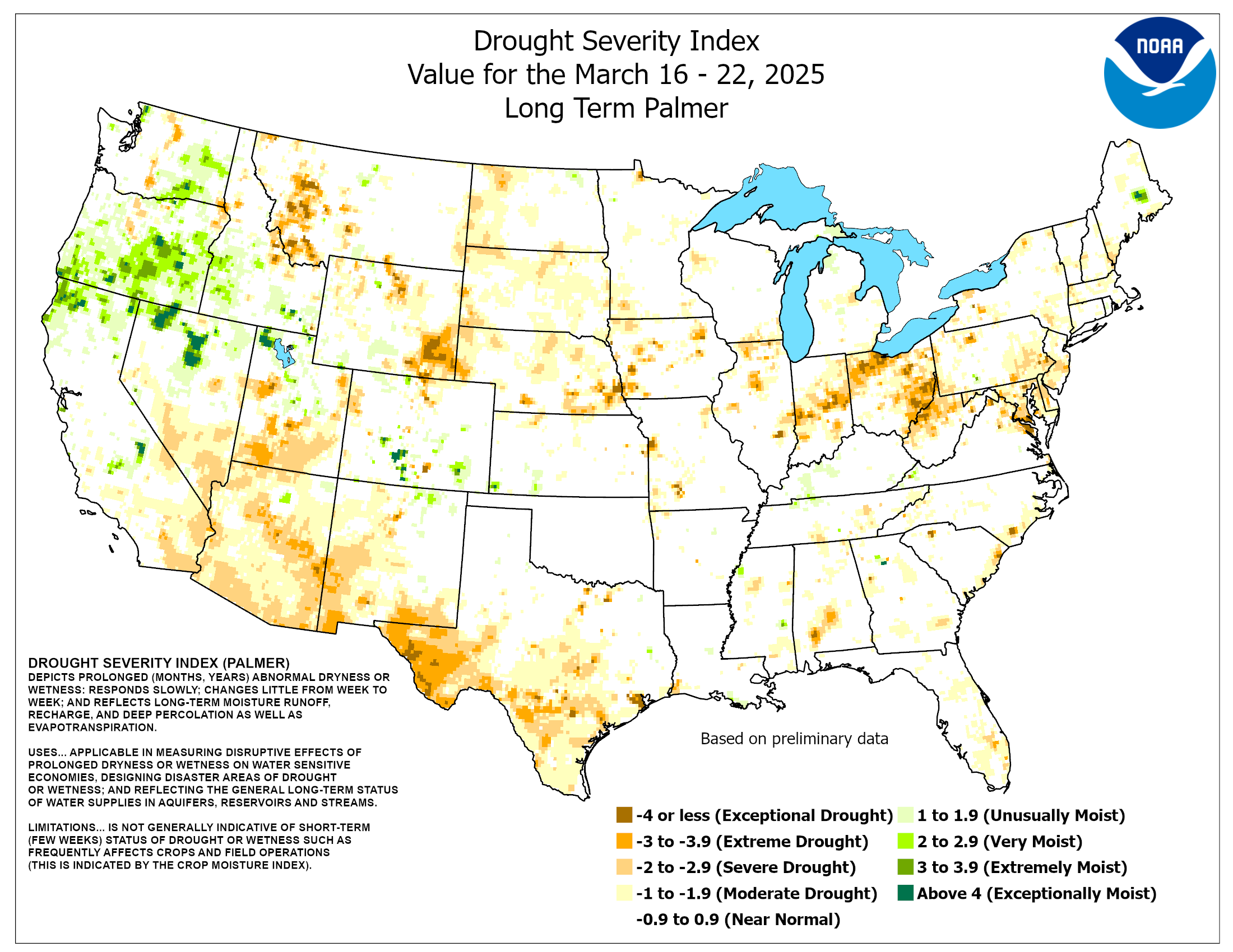
The Palmer Drought Severity Index (PDSI) shows shows dryness in shades of brown across much of the US, and some wetter areas in northern reaches of the US.
https://www.cpc.ncep.noaa.gov/products/analysis_monitoring/regional_monitoring/palmer/PDSI.png
Five Facts About the United States Drought Monitor
1. Numerous agencies use the U.S. Drought Monitor.
2. The USDM is made with more than precipitation data.
3. A real person, using real data, updates the map.
4. The USDM provides a current snapshot, not a forecast.
5. Your input can be part of the drought-monitoring process.
All true.
#USDroughtMonitor #USDM #drought
https://www.farmers.gov/blog/five-facts-about-united-states-drought-monitor
Precipitation has been below normal for much of the US in the first third of 2026. Parts of the western Great Plains and the Southeast have received 50% or less of normal, while the Texas and Oklahoma panhandles and southwest Arizona got 25% or less. Precip was much above normal around the Great Lakes.

Updated daily, these maps allow you to review recent and past climate information across the United States. Over 250,000 maps are available in an archive dating to 2003.
(hprcc.unl.edu)

Drought intensified in parts of the eastern US and Great Plains, while drought eased in the Midwest and South. Conditions were mixed in other parts of the country. Drought (D1-D4) coverage dipped slightly by 1.1 points to 61.68%. Still a huge percentage of the US in drought.
Fires Rage in Georgia
An extreme drought that has gripped the Southeast for months helped fuel two large, destructive, human-caused wildland fires in southern Georgia in April 2026. The Pineland Road and Highway 82 fires together burned more than 50,000 acres (20,000 hectares) as of April 28, according to the Georgia Forestry Commission.
https://science.nasa.gov/earth/earth-observatory/fires-rage-in-georgia/
Much-needed rains revive Iraq’s fabled Mesopotamian Marshes
Years of drought, blamed on climate change and upstream dams in neighboring countries, have ravaged Iraq’s marshes — the reputed home of the biblical Garden of Eden — nestled between the mighty Tigris and Euphrates rivers.
Blue crabs spotted in James River in Richmond, Virginia amid drought
Reduced freshwater runoff into the Chesapeake Bay has allowed saltier water from the Bay to push farther upstream, increasing salinity levels in the James River and making it easier for species such as blue crabs to travel inland as far as the I-95 bridge in Richmond.
https://www.12onyourside.com/2026/04/28/blue-crabs-spotted-james-river-amid-drought-conditions/
‘Lowest I’ve seen the river,’ Savannah Riverkeeper official says amid drought, fires
The Savannah River is the source of water for many fire departments but it hasn’t received any heavy rain recently to replenish the river.
industries have not reduced the amount of waste that they dump into the river, so it’s becoming very dirty.
@ai6yr
Like it!
The graph of water being released from Flaming Gorge on the Wyoming/Utah border to bolster Lake Powell.
https://www.usbr.gov/uc/water/hydrodata/reservoir_data/917/dashboard.html#total_release/

