#PPOD: This image from the Copernicus Sentinel-1 mission shows us the maritime traffic passing through the Øresund Strait in 2025.
-
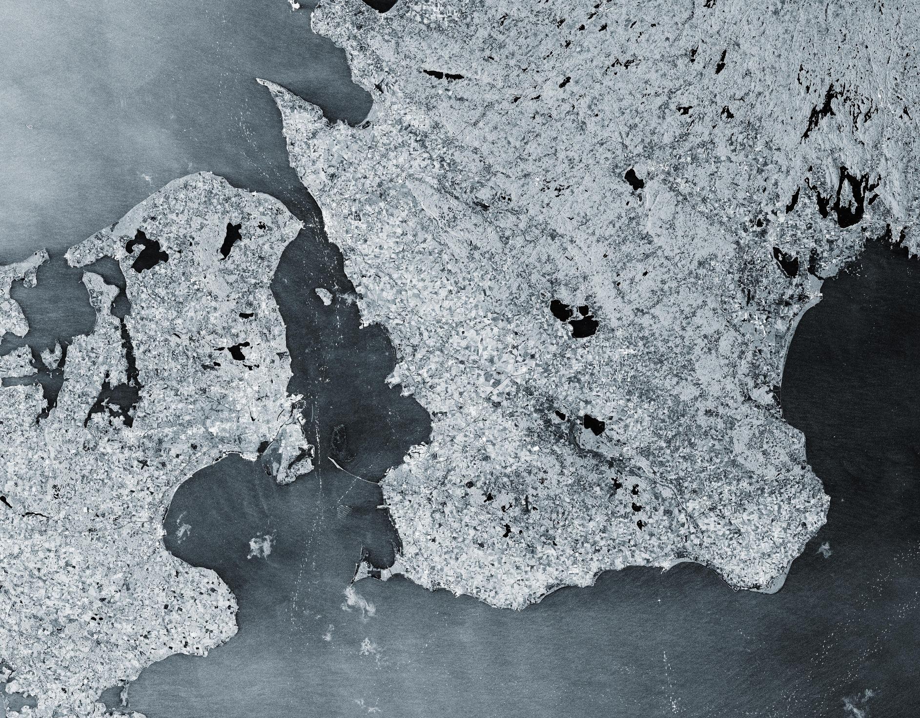
#PPOD: This image from the Copernicus Sentinel-1 mission shows us the maritime traffic passing through the Øresund Strait in 2025. The 118-km-long Øresund Strait (also known as the Sound) separates Denmark to the west from Sweden to the east and links the Baltic Sea to the North Sea, which makes it one of the busiest waterways in the world.
In this image, ships appear as bright, sparkly dots in the dark waters of the strait.
-
#PPOD: This image from the Copernicus Sentinel-1 mission shows us the maritime traffic passing through the Øresund Strait in 2025. The 118-km-long Øresund Strait (also known as the Sound) separates Denmark to the west from Sweden to the east and links the Baltic Sea to the North Sea, which makes it one of the busiest waterways in the world.
In this image, ships appear as bright, sparkly dots in the dark waters of the strait.
Sentinel-1 satellites carry radar instruments to provide an all-weather, day-and-night supply of imagery of Earth’s surface, making it ideal to monitor ship traffic. Here, more than 50 radar images over the same area, acquired every six days throughout 2025, have been compressed into a single image.
Credit: contains modified Copernicus Sentinel data (2025), processed by ESA
Learn more: https://www.esa.int/ESA_Multimedia/Images/2026/03/Earth_from_Space_Maritime_highways_in_the_OEresund_Strait
-
R relay@relay.publicsquare.global shared this topicR relay@relay.infosec.exchange shared this topicR relay@relay.mycrowd.ca shared this topic